L. David Roper
http://www.roperld.com/personal/RoperLDavid.htm
04-May-2022
The proposed Keystone XL pipeline in north-central U.S. and several natural-gas pipelines proposed for crossing Virginia have the main purposes to take oil-sands oil in Alberta Canada, fracked tight oil in North Dakota and fracked natural gas in Pennsylvania and northern West Virginia to the coast to ship overseas at higher prices than in the U.S. Fracking for tight oil and for natural gas has been occurring so fast that prices for crude oil and natural gas have been dropping very fast, which is the impetus for building the pipelines.
See http://www.wtrg.com/daily/clfclose.gif and http://www.wtrg.com/daily/ngfclose.gif for crude-oil and natural-gas prices.
http://www.roperld.com/science/minerals/USOilBoom_Bust.htm
http://www.roperld.com/science/minerals/USGasBoom_Bust.htm
As a personal privilege I include a pipeline map of my birth county, Ellis County OK (Red = gas, blue = hazardous liquid):
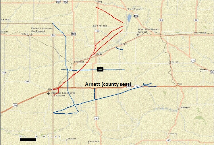
The horizontal blue gas pipeline in the middle crossed my father's farm, roughly represented by the black rectangle.
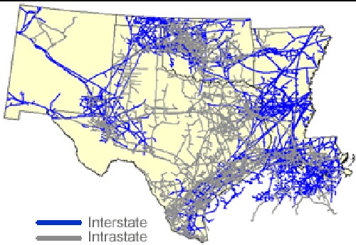
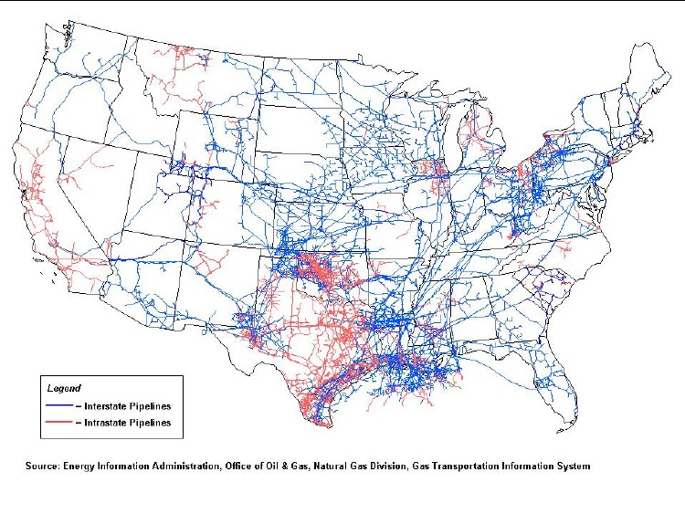
I show this to point out that interstate pipelines are inevitably connected by many dendritic intrastate pipelines, especially where there are many gas wells such as Oklahoma, Texas and Louisiana. I was born in northwest Oklahoma and recently was back there and observed the many fracked gas and oil wells and their attendant pipelines.
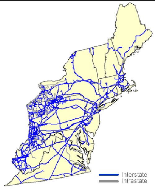
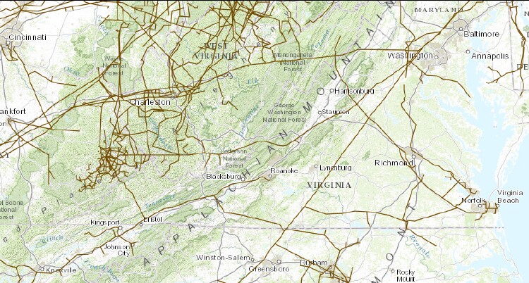
Virginia and West Virginia are included in the northeast sector instead of the southeast sector.
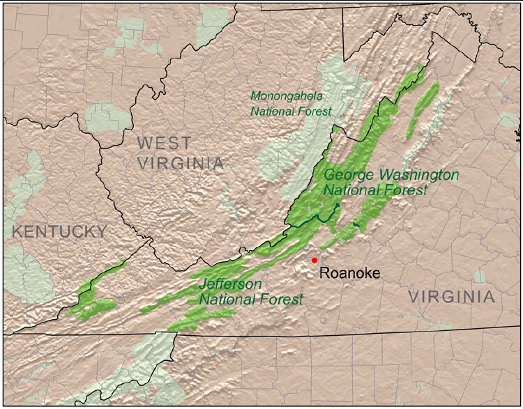
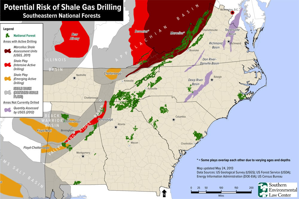
If fracking for natural gas occurs in the Appalachian Mountains there will be many intrastate pipelines dendritic to the interstate pipelines. Discussions of fracking in the Appalachian Mountains should include discussing the accompanying dendritic pipelines.
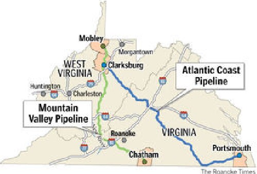
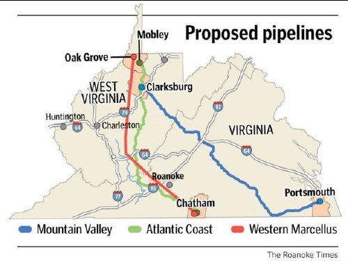
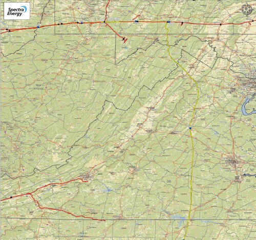
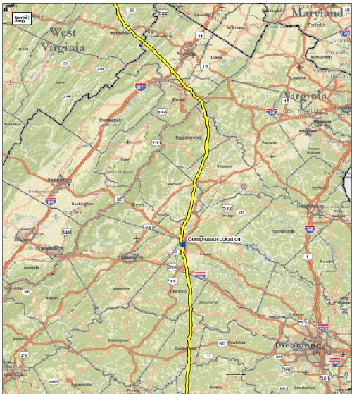
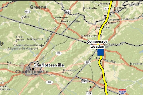
Three new natural-gas pipelines have recently been proposed that cross Virginia and West Virginia.
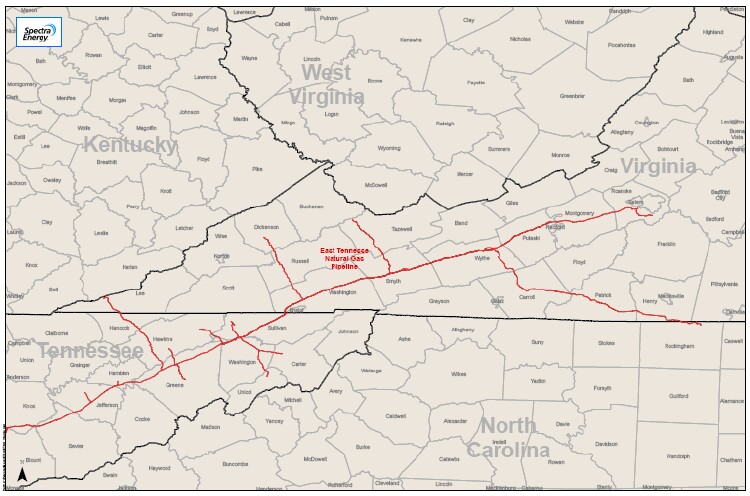
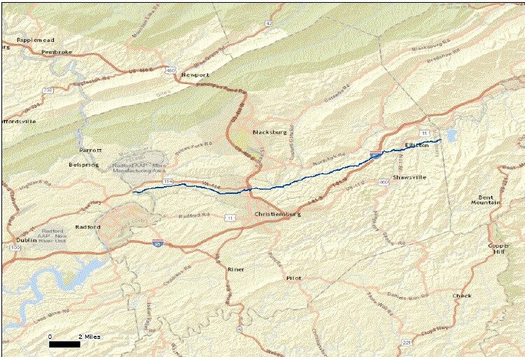
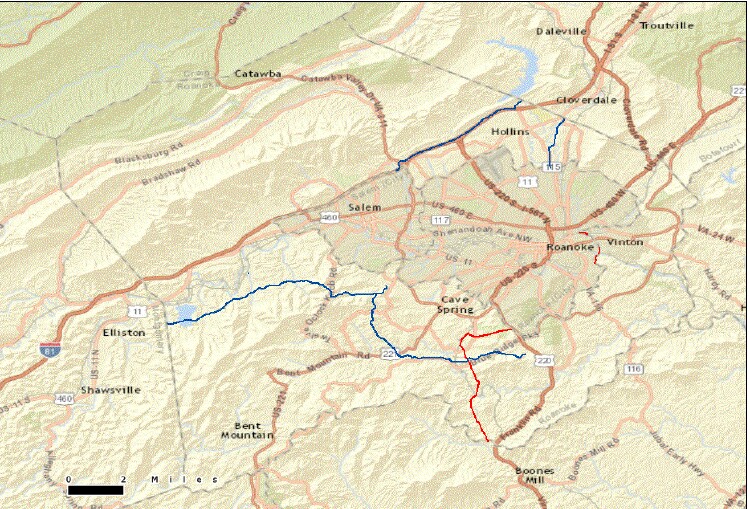
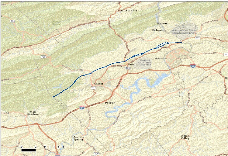
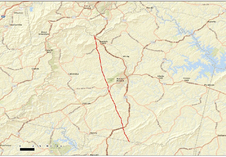
It is a 42" diameter pipe about 330-miles long, about 20 miles in Floyd County VA.
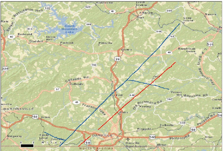
County maps for Mountain Valley pipeline
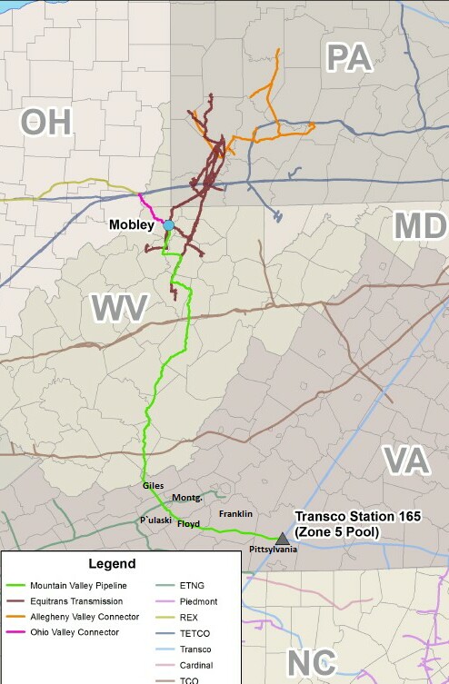
Note in the two maps above that the proposed Mountain Valley pipeline connects to a pipeline in Pittsylvania Co. VA that continues on to the Norfolk area on the coast. It appears that a main reason for the pipeline is to take natural gas to the coast of Virginia where it could be liquefied (LNG) and exported.
One wonders why a more direct route from West Virginia to Pittsylvania County VA was not chosen.
Numbers about the MVP:
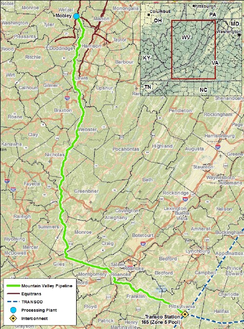
427-miles pipeline starts in PA and terminates in NC.
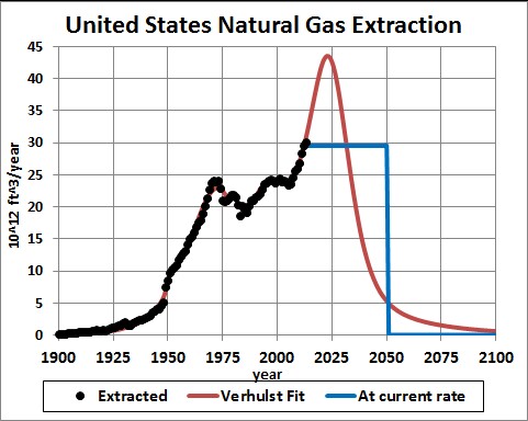
The red-curve fit to the extraction data uses a high value for reserves (1352 trillion cubit feet) and assumes that the final peak is symmetric. The blue lines show when the reserves would run out (~year 2050) if the future yearly extraction rates were the same as for 2013.
If anyone claims that natural-gas extraction in the U.S. will last for decades, ask that person to show the projected depletion curve and tell what is the area under the projected curve, the remaining reserves. Then compare that reserves estimate to the EIA reserves estimate.
Extraction may peak sooner than 2024. The rapid reduction after the peak will be economically traumatic after the economic system has adjusted to such a fast rise before the peak. It would make sense to start reducing the extraction rate now slower than it will occur by the red curve after the peak.
Given the coming bust soon in natural-gas extraction in the U.S., does it make sense to build so many natural-gas pipelines in the U.S., to build natural-gas power plants and to convert vehicles to natural gas?
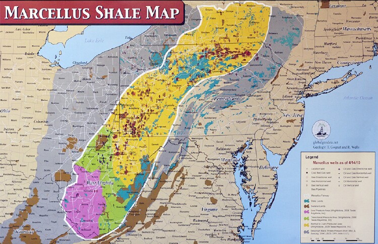
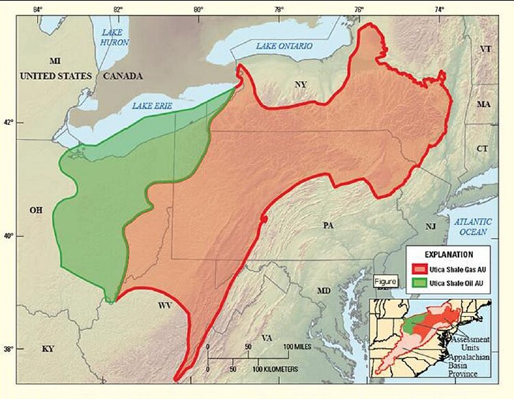
"It lies a few thousand feet under the Marcellus Shale."
EIA extraction estimates for 2014 and 2015 are included as "data" (green dots) in the fit.
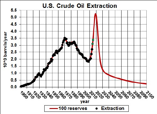
The red-curve fit to the extraction data uses a high value for reserves (100 billion barrels) and assumes that the final peak is symmetric.
Extraction may peak sooner than 2019. The rapid reduction after the peak will be economically traumatic after the economic system has adjusted to such a fast rise before the peak. It would make sense to start reducing the extraction rate now slower than it will occur by the red curve after the peak.
Since crude-oil extraction in the U.S. will peak soon, oil companies want to make it possible to transport oil from Canadian oil sands and North Dakota to world markets through a direct pipeline to Houston, Texas on Gulf of Mexico (Keystone XL pipeline). Relevant to this are projections of extraction of crude oil from Canadian oil sands and North Dakota:
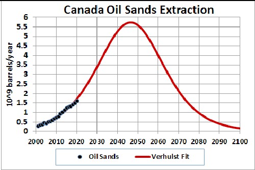
If all the Canadian oil sands are mined for crude oil, the Keystone XL pipeline will be in service for several decades.
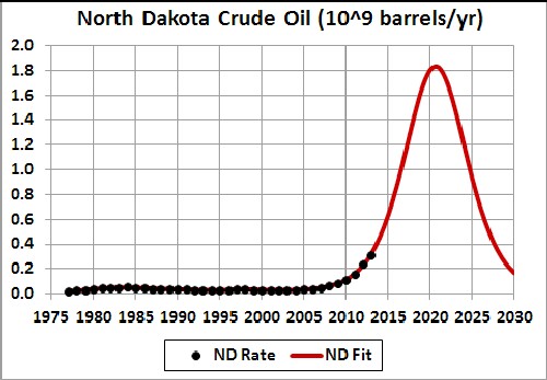
The North Dakota oil will feed the Keystone XL pipeline for only slightly more than one decade.
"The TransCanada Keystone Pipeline System is an oil pipeline system in Canada and the United States. It runs from the Western Canadian Sedimentary Basin in Alberta, Canada, to refineries in the United States in Steele City, Nebraska; Wood River and Patoka, Illinois; and the Gulf Coast of Texas. In addition to the synthetic crude oil (syncrude) and diluted bitumen (dilbit) from the oil sands of Canada, it also carries light crude oil from the Williston Basin (Bakken) region in Montana and North Dakota."
"Three phases of the project are in operation, and the fourth is awaiting U.S. government approval. Upon completion, the Keystone Pipeline System would consist of the completed 2,151-mile (3,462 km) Keystone Pipeline (Phases I and II), Keystone Gulf Coast Expansion (Phase III), and the proposed Keystone XL Pipeline Project (Phase IV). Phase I, delivering oil from Hardisty, Alberta, to Steele City, Wood River, and Patoka, was completed in the summer of 2010. Phase II, the Keystone-Cushing extension, was completed in February 2011 with the pipeline from Steele City to storage and distribution facilities at Cushing, Oklahoma. These two phases have the capacity to deliver up to 590,000 barrels per day (94,000 m3/d) of oil into the Mid-West refineries. Phase III, the Gulf Coast Extension, which was opened in January 2014, has capacity up to 700,000 barrels per day (110,000 m3/d). The proposed Phase IV, would begin in Hardisty, Alberta, and extend to Steele City, essentially replacing the existing phase I pipeline."
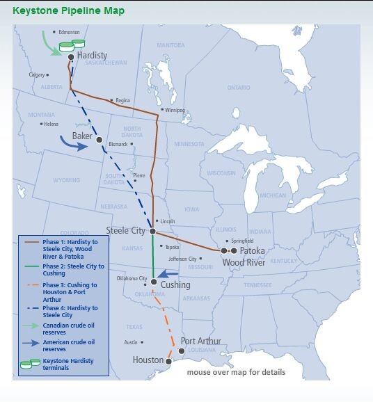
Phase 4 is called the Keystone XL pipeline; XL stands for eXport Limited. It is to replace the Phase-1 Keystone pipeline as a more direct route to a port in Houston, Texas on the Gulf of Mexico.
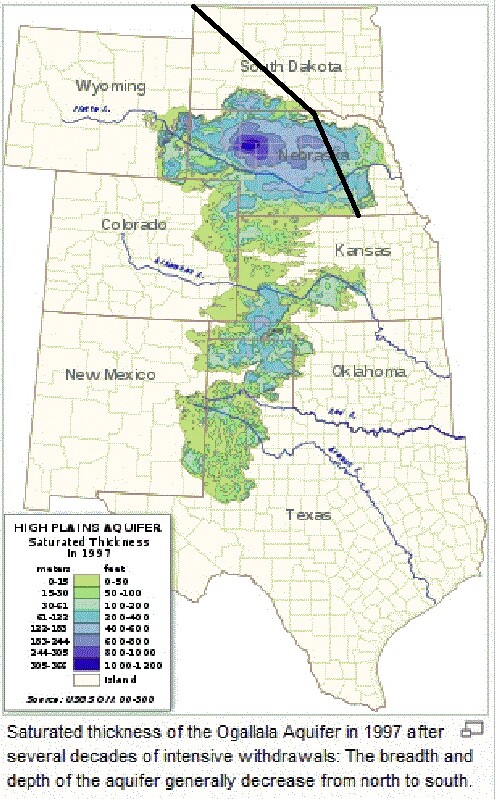
Note that the Phase 4 (XL) pipeline crosses more of the Ogallala Aquifer than does the Phase 1 pipeline it is to replace. TransCanada has proposed another route that does not cross the Ogallala Aquifer or the Sandhills in Nebraska, a National Natural Landmark,which lie right on top of the deepest part of the Ogallala Aquifer:
L. David Roper interdisciplinary studies
L. David Roper, http://arts.bev.net/RoperLDavid/
4 May, 2022